


UTAN Transardennaise - étape 1 23-08-2021

guy284
User

Length
19.3 km

Max alt
492 m

Uphill gradient
544 m
Km-Effort
26 km

Min alt
217 m

Downhill gradient
316 m
Boucle
No
Creation date :
2019-12-12 22:30:23.858
Updated on :
2021-08-22 16:50:45.084
5h46
Difficulty : Difficult

FREE GPS app for hiking
 SityTrail
IGN / Geographical institutes
SityTrail Plus
The world is yours!
About
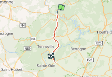
Trail Walking of 19.3 km to be discovered at Wallonia, Luxembourg, La Roche-en-Ardenne. This trail is proposed by guy284.
Description
La Roche-en-Ardenne (Quai de l'Ourthe) / Barrière Hinck
Positioning
Country:
Belgium
Region :
Wallonia
Department/Province :
Luxembourg
Municipality :
La Roche-en-Ardenne
Location:
Unknown
Start:(Dec)
Start:(UTM)
683831 ; 5562182 (31U) N.
Comments